Salween River
A major Southeast Asian river flowing through China, Myanmar, and Thailand.

via Wikipedia: Salween River · see source
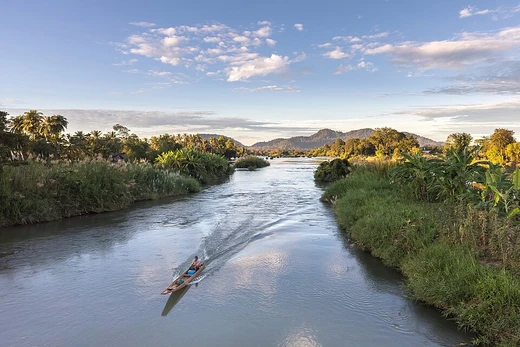
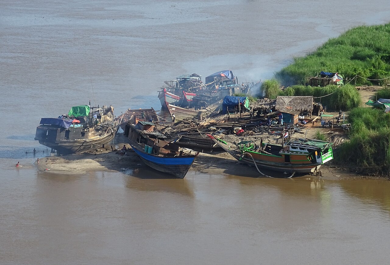
The Salween is a Southeast Asian river, about 3,289 km (2,044 mi) long, flowing from the Tibetan Plateau south into the Andaman Sea. It flows primarily within southwest China and eastern Myanmar, with a short section forming the border of Myanmar and Thailand. Throughout most of its course, it runs swiftly through rugged mountain canyons. Despite the river's great length, only the last 90 km (56 mi) are navigable, where it forms a modest estuary and delta at Mawlamyine. The river is known by various names along its course, including the Thanlwin (named after an olive-like plant) in Myanmar and the Nu Jiang (or Nu River, named after the Nu people) in China. The commonly used spelling "Salween" is an anglicisation of the Burmese name dating from 19th-century British maps. Due to its great range of elevation and latitude coupled with geographic isolation, the Salween basin is considered one of the most ecologically diverse regions in the world.
- length
- about 3,289 km (2,044 mi)
- source
- Tanggula Mountains, Tibetan Plateau
- mouth
- Andaman Sea
- basin_area
- about 283,500 km² (109,500 mi²)
- average_flow_at_mouth
- 6,600 m³/s (230,000 cu ft/s)
- navigable_length
- only the last 90 km (56 mi)
Verified Timeline
Lore & Background
The Salween originates in the Tanggula Mountains in the central Tibetan Plateau. The headwaters are located near Dengka Peak, east of Tanggula Pass. The highest source is Jiangmeiergang Galou glacier, 5,432 m (17,822 ft) above sea level. The various headwater streams flow southwest through high mountain valleys and accumulate in Cona Lake, at 4,594 m (15,072 ft). Downstream of the lake, the Tibetan section of the river is called Gyalmo Nagqu, "black river". In Tibet the river flows mostly within Nagqu prefecture. In Yunnan, the Salween is known as the Nujiang or Nu River, after the indigenous Nu people. For more than 1,000 km (620 mi) the Salween runs parallel to, and west of the headwaters of the Mekong and Yangtze, separated by high mountain ridges of the Hengduan Mountains. Much of the river within Yunnan is part of the Three Parallel Rivers of Yunnan Protected Areas, a World Heritage Site. Forming canyons up to 4,500 m (14,800 ft) deep, this section is often called the "Grand Canyon of the East".
Reader's Guide
The Salween is one of the least fragmented large river systems in Asia, with only a few small dams in the headwaters of the river and on tributaries. As of 2017, the only two dams on the Salween River proper are the Chalong and Jiquan hydroelectric stations, both in Tibet. The river has extremely high hydropower potential, with a fall of more than 5,000 m (16,000 ft) from its source. Since the 1970s, the Myanmar and Thai governments have sought to build massive hydroelectric dams along the river. China also planned to dam the upper Salween, but in 2016 these plans were dropped in favor of establishing a national park. The future of dam projects in Myanmar and Thailand remains uncertain. The Salween basin is home to numerous ethnic minority groups, whose ancestors largely originated in the Tibetan Plateau and northwest China. Starting about 5,000 years ago, people began migrating south along the river, establishing small kingdoms and city-states. During the last 1,000 years, the Salween has defined various frontiers of the Burmese empires to the west, the Kingdom of Siam to the south, and Imperial China to the east, with the Shan States along the middle Salween being a frequently contested area. Since Burmese independence in 1948, the Salween basin has been a battleground for several fronts of the Myanmar civil war, with large areas in Shan State and Karen State (Kayin State) contested between the Myanmar military and local ethnic militias.
Did You Know?
- The highest source of the Salween is Jiangmeiergang Galou glacier, 5,432 m (17,822 ft) above sea level.
- Along with the Lancang and Jinsha rivers, the Salween flows through the Three Parallel Rivers World Heritage Site, which is believed to support over 25% of the world’s animal species.
- The average volume of sediment in the Salween Delta is around 180 million tonnes per year.
- Inle Lake, the second largest lake in Myanmar and a World Biosphere Reserve, drains into the Salween by way of the Pawn River.
- The Salween is tidally influenced up to 75 km (47 mi) inland.
The River's Physical Journey
The Salween stretches roughly 3,289 kilometres from its glacial birth on the Tibetan Plateau to its modest estuary where it meets the Andaman Sea near Mawlamyine. Its source sits near Dengka Peak in the Tanggula Mountains, with the highest contributing stream rising from the Jiangmeiergang Galou glacier at 5,432 metres. The young water collects in Cona Lake before threading through high valleys that the Tibetans call Gyalmo Nagqu, or "black river." For most of its length the water races through deep, rugged canyons, and despite covering more than three thousand kilometres, only the final ninety kilometres near the delta are navigable. The basin spans about 283,500 square kilometres, divided among China (48 percent), Myanmar (44 percent), and Thailand (8 percent), with a mean elevation of 3,515 metres. The river carries different names along its path: Nujiang in Yunnan, named for the indigenous Nu people, and Thanlwin in Myanmar, derived from an olive-like Elaeocarpus species that lines its banks. The English spelling "Salween" traces back to nineteenth-century British cartographers' rendering of the Burmese name.
A Living Tapestry of Species and Peoples
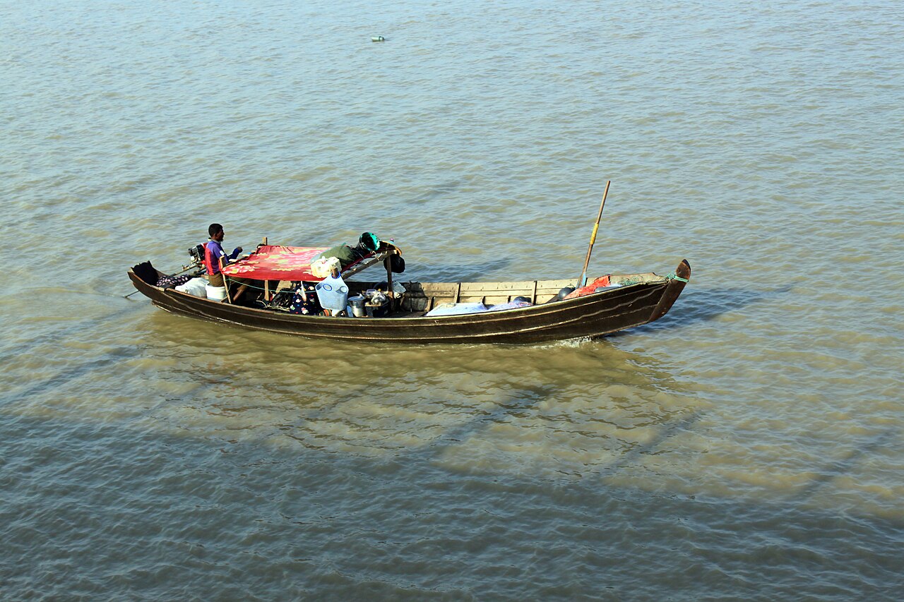
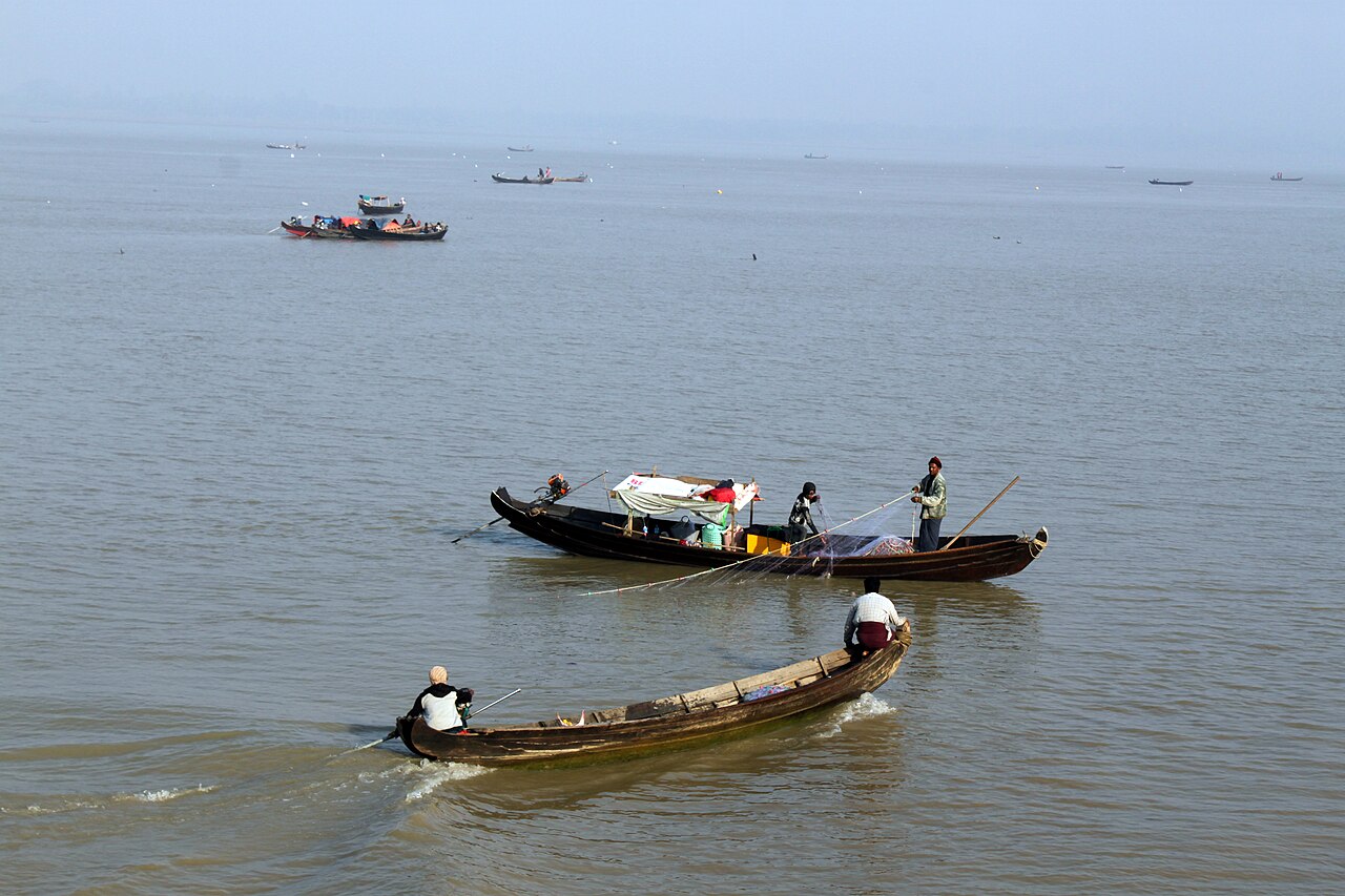
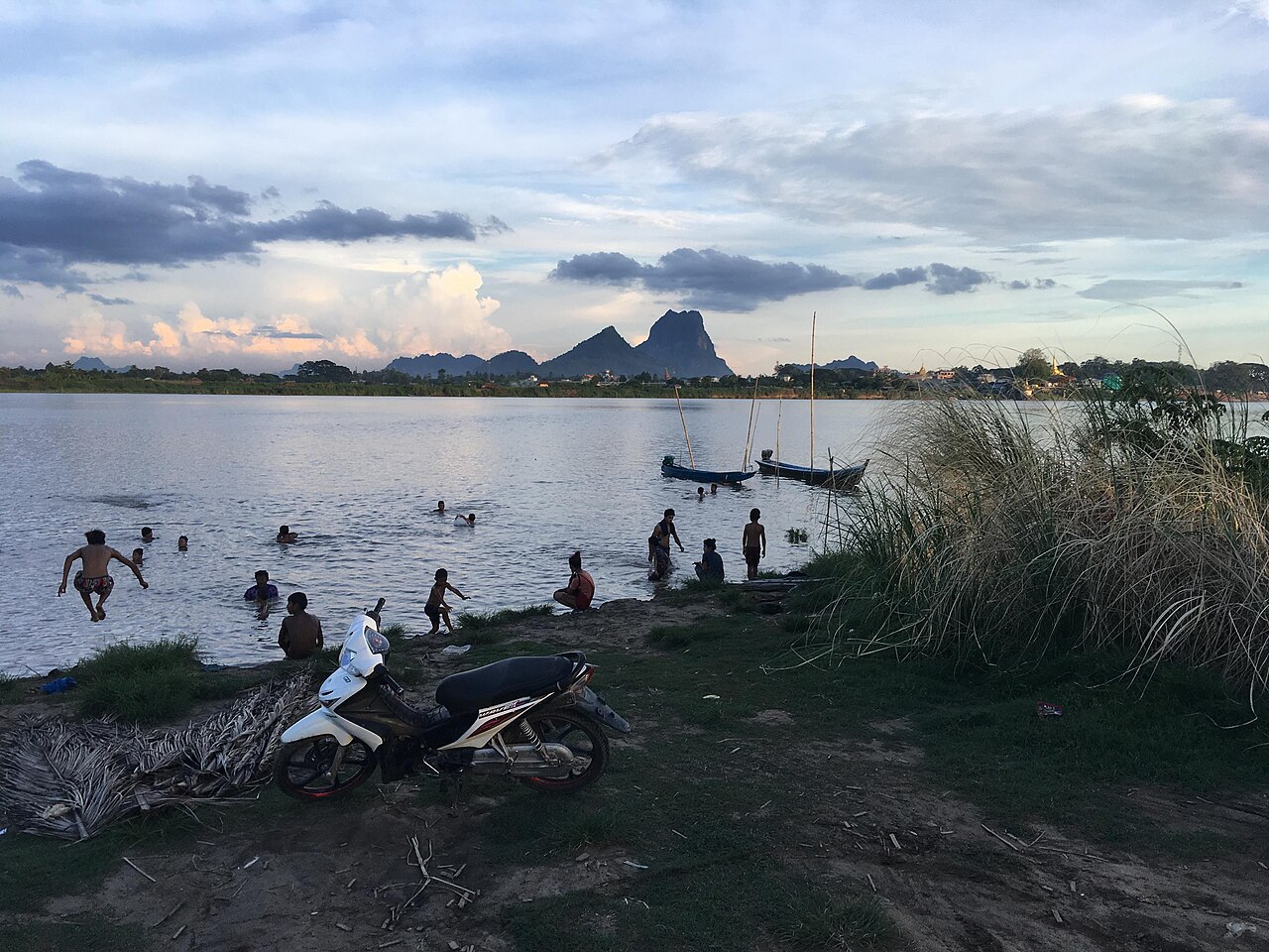
The Salween basin is widely regarded as one of the planet's most biologically rich zones, a distinction earned through its extraordinary range of elevation, latitude, and geographic isolation. Together with the Lancang and Jinsha rivers, it threads through the Three Parallel Rivers World Heritage Site, an area believed to shelter more than a quarter of all animal species on Earth. The river sustains agriculture and supports prolific fisheries, particularly in its delta region. Beyond its natural wealth, the basin is a cradle of human diversity. Ancestors of today's ethnic communities largely originated on the Tibetan Plateau and in northwest China, and from roughly 5,000 years ago they began migrating southward along the waterway, founding small kingdoms and city-states. The basin now holds an estimated 24 million people, with about 10 million living in close proximity to the river itself. Communities range from the Blang, Derung, Lisu, Nu, and Wa of China to the Akha, Lahu, Hmong, Karen, Karenni, Kokang, Pa'O, and Shan of Myanmar, creating a mosaic of languages and traditions. Population density varies dramatically, from 300 people per square kilometre in Mon State down to just five in the frigid Tibetan headwaters.
A River That Drew Borders
For at least a millennium, the Salween has served as a living boundary between competing powers. To its west lay the Burmese empires, to the south the Kingdom of Siam, and to the east the domain of Imperial China. The Shan States, straddling the middle reaches of the river, were a perennially contested zone where these three spheres of influence clashed. In the nineteenth century the British Empire pressed into Burma, and Mawlamyine—the modest estuary town at the river's mouth—became the colonial administrative capital for decades. After Myanmar won independence in 1948, the same river basin that had once demarcated imperial frontiers became the theatre of a prolonged civil war. Large swaths of Shan State and Karen State (Kayin State) remain contested between the Myanmar military and local ethnic militias, making the Salween corridor one of the country's most volatile and strategically sensitive regions. The waterway thus carries not only sediment and fish but also the weight of centuries of political rivalry and unresolved conflict.
The Dam Question and a River's Future
The Salween remains one of Asia's least fragmented major river systems. As of 2017, only two small hydroelectric stations—Chalong and Jiquan—sit on the river proper in the Tibetan headwaters, with a handful of minor dams on tributaries. Yet the river's physical profile makes it a magnet for energy development: it drops more than 5,000 metres from source to sea, giving it enormous hydropower potential. Since the 1970s, both Myanmar and Thailand have pursued plans for massive hydroelectric dams along the waterway, and China once drafted a scheme to dam the upper Salween. In 2016, however, Beijing withdrew those plans and instead designated the area as a national park, a decision that shifted the conversation toward conservation. The fate of the proposed Myanmar and Thai projects remains unresolved, leaving the river at a crossroads. Its future will hinge on whether the ecological and cultural value of one of the world's most biodiverse basins is weighed against the economic promise of harnessing its extraordinary vertical drop.
Gallery

Frequently Asked Questions
Who is Salween River?
Salween River is a major Southeast Asian waterway stretching roughly 3,289 km (2,044 mi) from the Tanggula Mountains on the Tibetan Plateau all the way south to the Andaman Sea. Its course runs primarily through southwest China and eastern Myanmar, with a brief stretch serving as the border between Myanmar and Thailand.
What are Salween River's powers/role?
The river carves rapidly through deep, rugged mountain canyons for most of its length, making it one of the most dramatic and least accessible waterways in the region. Because only the final 90 km (56 mi) near the mouth are navigable, it has historically served more as a geographic barrier and ecological corridor than a trade route.
How does Salween River's story end?
Salween River's journey concludes where it discharges into the Andaman Sea, releasing an average of about 6,600 m³/s (230,000 cu ft/s) of water into the ocean. This final stretch marks the transition from its wild canyon course to the open coastal waters of the Malay Peninsula.
Why is Salween River important?
Its basin covers roughly 283,500 km² (109,500 mi²) and, thanks to the extreme range of elevation and latitude combined with geographic isolation, it shelters an exceptionally rich and diverse set of plant and animal communities. The river also defines the natural boundaries and cultural identities of three nations—China, Myanmar, and Thailand.
What are Salween River's aliases?
In Myanmar the river is commonly called the Thanlwin, while in China it goes by the name Nu Jiang. The international designation "Salween" is the name most frequently used in English-language geography and literature.
More in Rivers 1-16
Spotted an error? Know more?
This is a living reference — every entry is fact-audited, and reader corrections feed straight into our audit queue. Suggest an edit · See this site's audit record