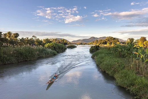
Ubangi River
Central African river, largest right-bank tributary of the Congo.

via Wikipedia: Ubangi River · see source
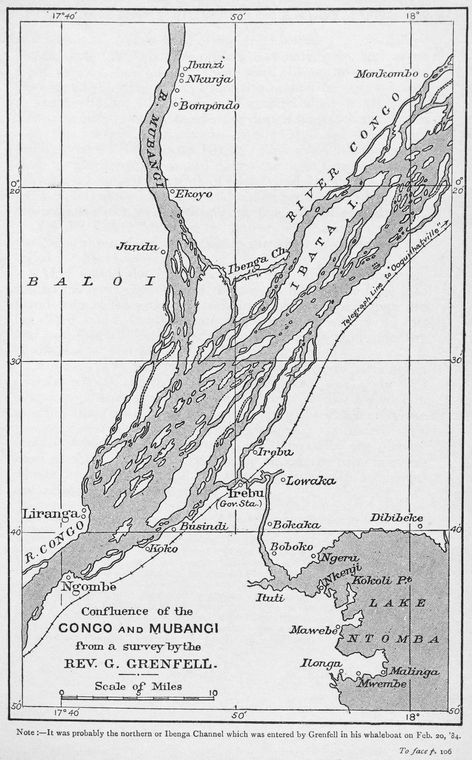
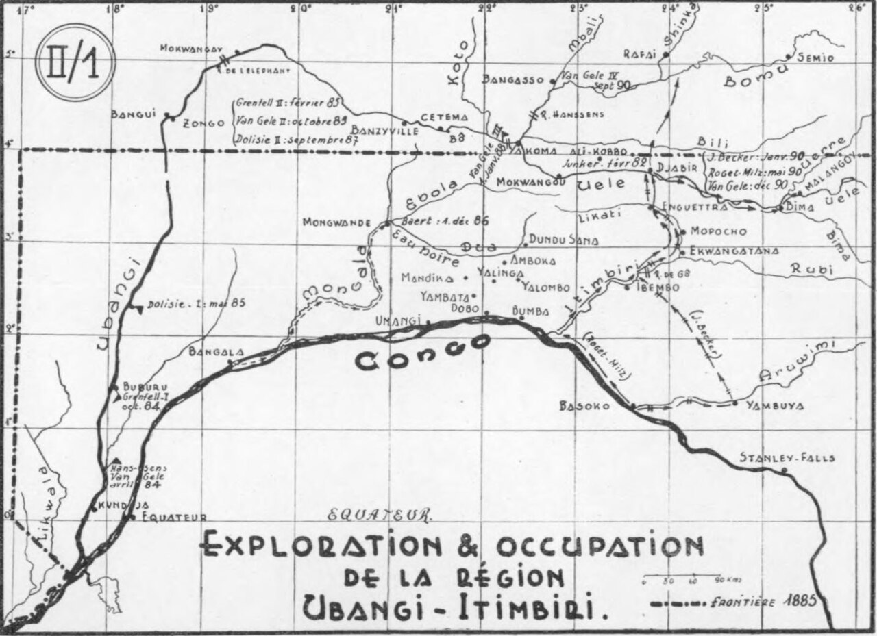
The Ubangi River (also spelled Oubangui) is a river in Central Africa and the largest right-bank tributary of the Congo River. It begins at the confluence of the Mbomou and Uele Rivers and flows west, forming the border between the Central African Republic (CAR) and the Democratic Republic of the Congo (DRC). The Ubangi then bends to the southwest and passes through Bangui, the capital of the CAR, after which it flows south – forming the border between the DRC and the Republic of the Congo. The Ubangi finally joins the Congo River at Liranga. Its length is about 1,060 km, and its total length with the Uele, its longest tributary, is 2,270 km.
- length
- about 1,060 km (660 mi)
- total length with Uele
- 2,270 km (1,410 mi)
- drainage basin
- about 651,915 km² (251,706 mi²)
- average discharge at Bangui
- ~4,000 m³/s (140,000 cu ft/s)
- mean annual discharge at mouth
- ~6,000 m³/s (210,000 cu ft/s)
- source confluence
- Mbomou and Uele Rivers
- mouth
- Congo River at Liranga
Lore & Background
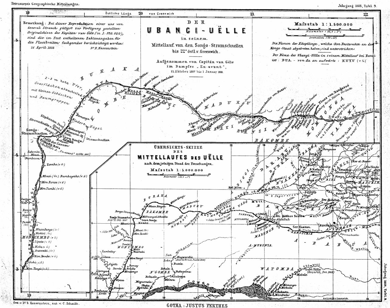
The Ubangi River begins at the confluence of the Mbomou River (mean annual discharge 1,350 m³/s) and the Uele River (mean annual discharge 1,550 m³/s). It flows west, forming the border between the Central African Republic and the Democratic Republic of the Congo. Subsequently, the Ubangi bends to the southwest and passes through Bangui, the capital of the CAR, after which it flows south – forming the border between the DRC and the Republic of the Congo. The Ubangi finally joins the Congo River at Liranga. Its length is about 1,060 km (660 mi). Its total length with the Uele, its longest tributary, is 2,270 km (1,410 mi). The Ubangi's drainage basin is about 651,915 km² (251,706 mi²). Its discharge at Bangui ranges from about 800 m³/s (28,000 cu ft/s) to 11,000 m³/s (390,000 cu ft/s), with an average flow of about ~4,000 m³/s (140,000 cu ft/s). Its mean annual discharge at the mouth is around ~6,000 m³/s (210,000 cu ft/s). It is believed that the Ubangi's upper reaches originally flowed into the Chari River and Lake Chad before being captured by the Congo in the early Pleistocene.
Reader's Guide
Together with the Congo River, the Ubangi provides an important transport artery for river boats between Bangui and Brazzaville. From its source to 100 km below Bangui, the Ubangi defines the boundary between the Central African Republic and the Democratic Republic of the Congo. Thereafter, it forms the boundary between the DRC and the Republic of Congo until it empties into the Congo River. In the 1960s, a plan was proposed to divert waters from the Ubangi to the Chari River. According to the plan, named Transaqua, the water from the Ubangi would revitalize Lake Chad and provide a livelihood in fishing and enhanced agriculture to tens of millions of central Africans and Sahelians. Inter-basin water transfer schemes were proposed in the 1980s and 1990s by Nigerian engineer J. Umolu and the Italian firm Bonifica. In 1994, the Lake Chad Basin Commission (LCBC) proposed a similar project, and at a March 2008 summit the heads of state of the LCBC member countries committed to the diversion project. In April 2008, the LCBC advertised a request for proposals for a feasibility study.
Did You Know?
- The Ubangi River is the largest right-bank tributary of the Congo River.
- It begins at the confluence of the Mbomou River (mean annual discharge 1,350 m³/s) and the Uele River (mean annual discharge 1,550 m³/s).
- Its discharge at Bangui ranges from about 800 m³/s to 11,000 m³/s.
- It is believed that the Ubangi's upper reaches originally flowed into the Chari River and Lake Chad before being captured by the Congo in the early Pleistocene.
- In 1994, the Lake Chad Basin Commission proposed a project to divert waters from the Ubangi to the Chari River to replenish Lake Chad.
Course and Geographic Identity
The Ubangi River—known across languages as Mto Ubangi in Swahili, Fleuve Oubangui in French, and Mubangi Stroom in Dutch—stands as the largest right-bank tributary feeding into the Congo River in Central Africa. Its journey begins where the Mbomou, carrying a mean annual discharge of roughly 1,350 cubic metres per second, meets the Uele, which contributes about 1,550 cubic metres per second. From that confluence point, the river heads westward, serving as the natural boundary between the Central African Republic and the Democratic Republic of the Congo. It then curves southwestward, threading through Bangui, the capital city of the Central African Republic, before turning south to delineate the border between the DRC and the Republic of the Congo. Its final stretch ends at Liranga, where it merges into the Congo. Measuring approximately 1,060 kilometres on its own, the Ubangi stretches to 2,270 kilometres when the Uele, its longest tributary, is included in the calculation.
Hydrology and Ancient Origins
The Ubangi drains a vast basin covering roughly 651,915 square kilometres, making it one of the most significant waterways in the region. Flow conditions vary dramatically along its length: at Bangui, discharge swings from a low of about 800 cubic metres per second to a peak near 11,000 cubic metres per second, with a mean flow hovering around 4,000 cubic metres per second. By the time the river reaches its mouth at Liranga, the mean annual discharge settles at approximately 6,000 cubic metres per second. Perhaps most fascinating is the geological history embedded in the river's upper reaches. Scientists believe that, long before the present configuration, the headwaters of the Ubangi actually drained into the Chari River and ultimately into Lake Chad. A major river-capture event during the early Pleistocene epoch redirected those waters into the Congo system, fundamentally reshaping the hydrology of Central Africa and leaving the Ubangi as part of the Congo's network rather than the Chad Basin's.
Transport Artery and Border Significance
Beyond its physical geography, the Ubangi plays a critical role in the movement of people and goods across Central Africa. Together with the Congo River, it forms a vital waterway corridor for river boats linking Bangui in the Central African Republic with Brazzaville in the Republic of the Congo. This transport function gives the river a practical economic importance that extends well beyond its immediate banks. Equally significant is the river's political role: for the first stretch of its course, from its source down to roughly 100 kilometres below Bangui, the Ubangi serves as the international boundary separating the Central African Republic from the Democratic Republic of the Congo. Past that point, the river shifts its diplomatic function, marking the border between the DRC and the Republic of the Congo all the way to its confluence with the Congo River. In this way, a single waterway simultaneously defines the borders of three sovereign nations, making it one of the most geopolitically consequential rivers on the African continent.
The Transaqua Vision and Lake Chad
The Ubangi's waters have long attracted ambitious engineering proposals aimed at addressing water scarcity in the Sahel. As early as the 1960s, a plan called Transaqua was put forward to divert a portion of the Ubangi's flow into the Chari River, with the goal of revitalising the shrinking Lake Chad. Proponents argued that such a transfer would sustain fishing communities and boost agriculture, potentially supporting the livelihoods of tens of millions of people across central Africa and the Sahel region. The idea resurfaced during the 1980s and 1990s through inter-basin water transfer schemes championed by Nigerian engineer J. Umolu and the Italian firm Bonifica. In 1994, the Lake Chad Basin Commission advanced a comparable proposal, and by March 2008, the heads of state from all LCBC member nations formally committed to pursuing the diversion. Just one month later, in April 2008, the Commission issued a public call for proposals to commission a feasibility study, signalling a concrete step toward turning decades of discussion into an engineering project.
Gallery
Frequently Asked Questions
What is the Ubangi River?
The Ubangi (sometimes spelled Oubangui) is a major Central African waterway that serves as the largest tributary feeding the Congo River from its right bank. It winds westward and then southward through the region before emptying into the Congo at Liranga.
Where does the Ubangi River begin?
The river's source is defined by the confluence of the Mbomou and Uele rivers, after which the combined flow heads west and then turns south through the interior of Central Africa.
How long is the Ubangi River?
Measured on its own, the Ubangi stretches roughly 1,060 km (about 660 miles), though tracing the full system back through the Uele brings the combined length to approximately 2,270 km (1,410 miles).
Which countries does the Ubangi River form borders for?
The waterway acts as a natural boundary separating the Central African Republic from the Democratic Republic of the Congo and the Republic of the Congo, making it a politically significant international border.
Why is the Ubangi River important?
Beyond serving as a vital shipping and transport corridor for riverside communities, the river drains a basin of roughly 652,000 km² and has been proposed as a source for diversion schemes aimed at replenishing the shrinking Lake Chad.
More in Rivers 1-16
Spotted an error? Know more?
This is a living reference — every entry is fact-audited, and reader corrections feed straight into our audit queue. Suggest an edit · See this site's audit record