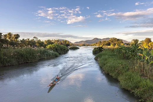
Senegal River
West African river forming part of the Senegal-Mauritania border.

via Wikipedia: Senegal River · see source
The Senegal River is a 1086-kilometre-long (675 mi) river in West Africa; much of its length marks part of the border between Senegal and Mauritania. It has a drainage basin of 270000 km2 (100000 sq mi), a mean flow of 680 m3/s (24,000 cu ft/s), and an annual discharge of 21.5 km3 (5.2 cu mi). Important tributaries are the Falémé River, Karakoro River, and the Gorgol River. The river divides into two branches once it passes Kaédi. The left branch, called the Doué, runs parallel to the main river to the north. After 200 km (120 mi) the two branches rejoin a few kilometers downstream of Podor.
- length
- 1,086 km (675 mi)
- drainage_basin
- 270,000 km² (100,000 sq mi)
- mean_flow
- 680 m³/s (24,000 cu ft/s)
- annual_discharge
- 21.5 km³ (5.2 cu mi)
Verified Timeline
Lore & Background
The Senegal's headwaters are the Semefé (Bakoye), and Bafing rivers which both originate in Guinea; they form a small part of the Guinea–Mali border before coming together at Bafoulabé in Mali. From there, the Senegal river flows west and then north through Talari Gorges near Galougo and over the Gouina Falls, then flows more gently past Kayes, where it receives the Kolimbiné. After flowing together with the Karakoro, it prolongs the former's course along the Mali–Mauritania border for some tens of kilometers till Bakel where it flows together with the Falémé River, which also has its source in Guinea, subsequently runs along a small part of the Guinea-Mali frontier to then trace most of the Senegal-Mali border up to Bakel. The Senegal further flows through semi-arid land in the north of Senegal, forming the border with Mauritania and into the Atlantic. In Kaedi, it accepts the Gorgol from Mauritania, flowing through Boghé it reaches Richard Toll where it is joined by the Ferlo coming from inland Senegal's Lac de Guiers. It passes through Rosso and approaching its mouth, around the Senegalese island on which the city of Saint-Louis is located, to then turn south. It is separated from the Atlantic Ocean by a thin strip of sand called the Langue de Barbarie before it pours into the ocean itself.
Reader's Guide
The area was previously occupied by the Serer people, who following their religious and ethnic persecution by Islamic forces in the 11th century, resulted in the Serer exodus to the south. The existence of the Senegal River was known to the early Mediterranean civilizations. It or some other river was called Bambotus by Pliny the Elder (possibly from Phoenician "behemoth" for hippopotamus) and Nias by Claudius Ptolemy. It was visited by Hanno the Carthaginian around 450 BCE at his navigation from Carthage through the pillars of Herakles to Theon Ochema (Mount Cameroon?) in the Gulf of Guinea. There was trade from here to the Mediterranean World, until the destruction of Carthage, and its west African trade net in 146 BCE. In the Early Middle Ages (c. 800 CE), the Senegal River restored contact with the Mediterranean world with the establishment of the Trans-Saharan trade route between Morocco and the Ghana Empire. Arab geographers, like al-Masudi of Baghdad (957), al-Bakri of Spain (1068) and al-Idrisi of Sicily (1154), provided some of the earliest descriptions of the Senegal River. Early Arab geographers believed the upper Senegal River and the upper Niger River were connected to each other, and formed a single river flowing from east to west, which they called the "Western Nile". Arab geographers Abd al-Hassan Ali ibn Omar (1230), Ibn Said al-Maghribi (1274), and Abulfeda (1331), label the Senegal as the "Nile of Ghana" (Nil Gana or Nili Ganah). As the Senegal River reached into the heart of the gold-producing Ghana Empire and later the Mali Empire, Trans-Saharan traders gave the Senegal its famous nickname as the "River of Gold". In 1972, Mali, Mauritania, and Senegal founded the Organisation pour la mise en valeur du fleuve Sénégal (OMVS) to manage the river basin. Guinea joined in 2005. The OMVS have looked at the feasibility of creating a navigable channel 55 m (180 ft) in width between the small town of Ambidédi in Mali, and Saint-Louis, a distance of 905 km (562 mi). It would give landlocked Mali a direct route to the Atlantic Ocean. The river has two large dams along its course. The Manantali Dam in Mali, and the Maka-Diama Dam downstream on the Mauritania-Senegal border. In between is the Félou Hydroelectric Plant, built in 1927, but replaced in 2014. The construction of the Gouina Hydroelectric Plant upstream of Felou at Gouina Falls began in 2013.
Did You Know?
- The Senegal River is called 'Seen O Gal' in Serer, a compound of the Serer term 'Seen' (from Roog Seen, Supreme Deity in Serer religion) and 'O Gal' (meaning 'body of water').
- Only three species of frogs and one fish are endemic to the Senegal-Gambia Catchments ecoregion.
- The river divides into two branches once it passes Kaédi; the left branch, called the Doué, runs parallel to the main river for 200 km (120 mi) before rejoining downstream of Podor.
- Arab geographers called the Senegal River the 'Nile of Ghana' (Nil Gana or Nili Ganah) and the 'River of Gold' due to its reach into gold-producing empires.
- The OMVS have studied creating a navigable channel 55 m (180 ft) in width between Ambidédi in Mali and Saint-Louis, a distance of 905 km (562 mi), to give landlocked Mali a direct route to the Atlantic Ocean.
Physical Geography and Course
The Senegal River stretches approximately 1,086 kilometres across West Africa, its waters ultimately feeding the Atlantic Ocean. Its origins lie in Guinea, where the Semefé (Bakoye) and Bafing rivers converge at Bafoulabé in Mali before the combined flow heads westward and then northward. Along its journey, the river threads through the Talari Gorges near Galougo, cascades over the Gouina Falls, and passes gently through Kayes. Several major tributaries feed into it: the Kolimbiné, the Karakoro, the Falémé (itself sourced in Guinea), the Gorgol from Mauritania, and the Ferlo from inland Senegal. A striking feature occurs downstream of Kaédi, where the river splits into two channels. The left branch, known as the Doué, runs parallel to the main stem for roughly 200 kilometres before the two reunite just beyond Podor, enclosing a long strip of land called Île à Morfil. Near its mouth, the river is separated from the open ocean by a narrow sandbar called the Langue de Barbarie. Its drainage basin spans 270,000 square kilometres, with a mean flow of 680 cubic metres per second and an annual discharge of 21.5 cubic kilometres.
International Cooperation and Engineering
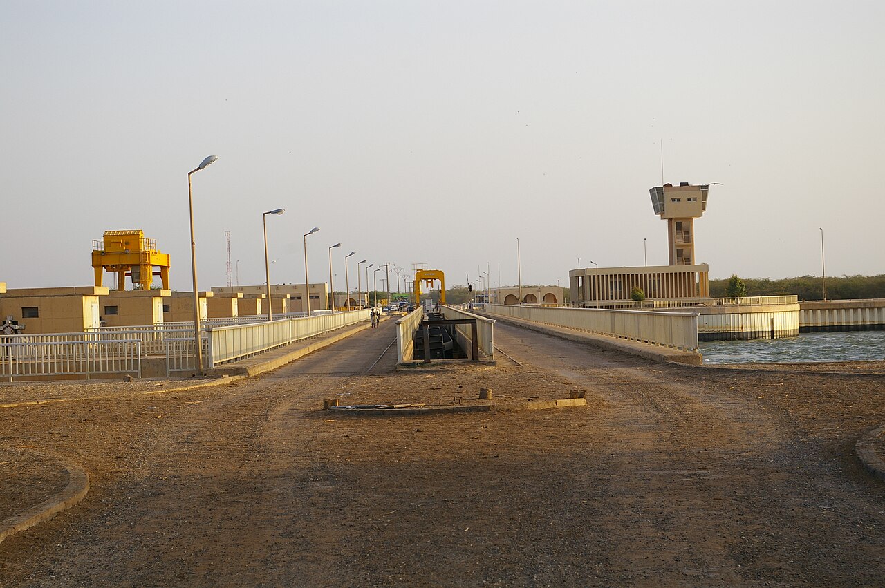
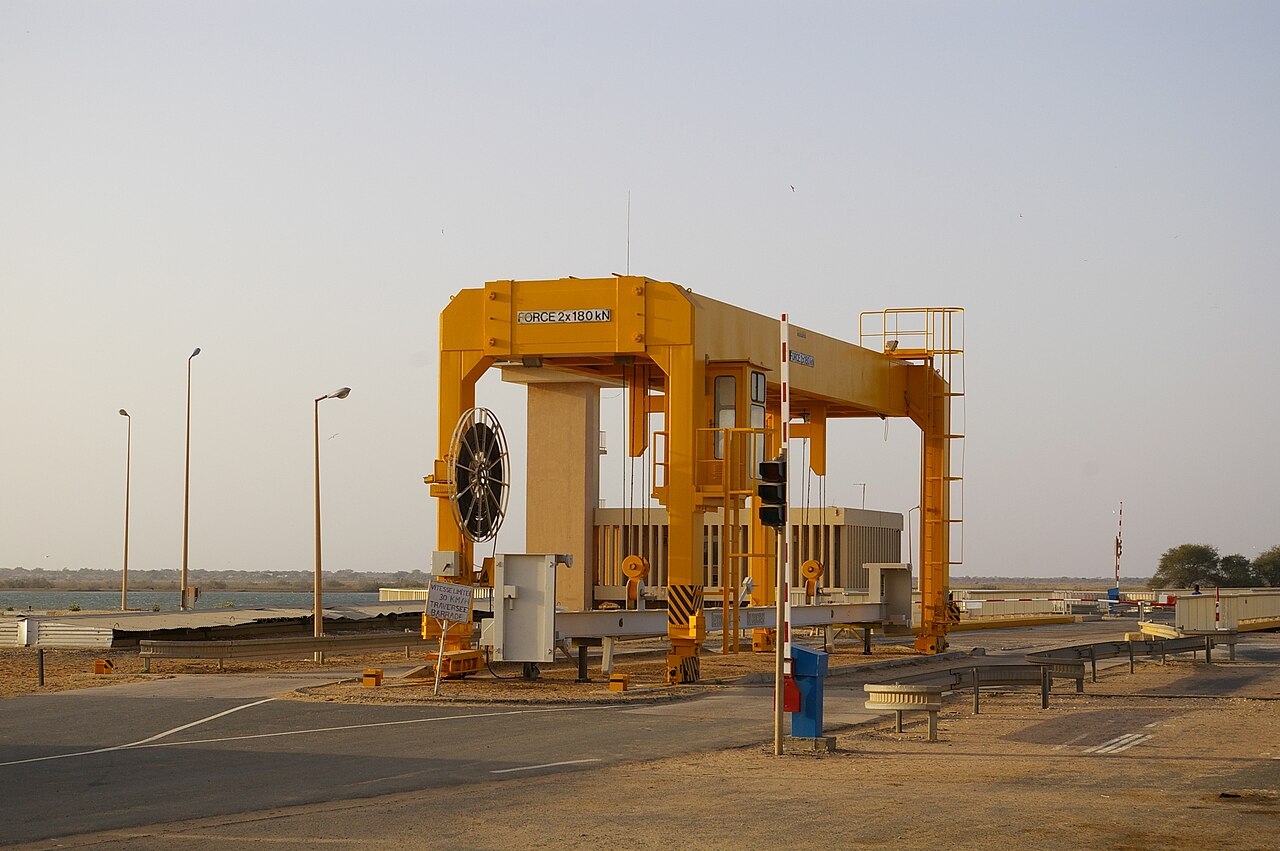
In 1972, three nations—Mali, Mauritania, and Senegal—established the Organisation pour la mise en valeur du fleuve Sénégal (OMVS) to coordinate management of the river's shared basin. Guinea later became a member in 2005. The OMVS has overseen significant infrastructure, including two major dams: the multi-purpose Manantali Dam in Mali and the Maka-Diama Dam on the Mauritania-Senegal border near the river's outlet, which prevents saltwater intrusion upstream. Between these structures lies the Félou Hydroelectric Plant, originally completed in 1927 using a weir system and subsequently replaced in 2014. Construction of the Gouina Hydroelectric Plant, positioned upstream at Gouina Falls, commenced in 2013. Beyond power generation, the OMVS has explored the possibility of a navigable channel 55 metres wide stretching 905 kilometres from Ambidédi in Mali to Saint-Louis. Such a waterway would grant landlocked Mali a direct maritime connection to the Atlantic, though as of 2012, commercial river transport remained extremely limited.
Ancient Knowledge and Historical Legacy
Long before modern cartography, the Senegal River was known to Mediterranean civilizations. Pliny the Elder referred to it—or possibly another waterway—as Bambotus, a name that may derive from the Phoenician word for hippopotamus. Claudius Ptolemy called it Nias. Around 450 BCE, the Carthaginian explorer Hanno is believed to have visited the river during his voyage from Carthage past the Pillars of Herakles toward the Gulf of Guinea. Trade networks linking the river to the Mediterranean flourished until Carthage's destruction in 146 BCE severed those western African commercial ties. In the Early Middle Ages, around 800 CE, the Trans-Saharan trade route between Morocco and the Ghana Empire reconnected the region to the wider world. Arab geographers including al-Masudi of Baghdad (957), al-Bakri of Spain (1068), and al-Idrisi of Sicily (1154) produced some of the earliest written descriptions of the river. Notably, these early scholars mistakenly believed the upper Senegal and upper Niger were connected. The Serer people, whose name for the river—Seen O Gal—references their Supreme Deity Roog Seen, inhabited the area before a 11th-century exodus southward following religious and ethnic persecution by Islamic forces.
Ecology and the Senegal-Gambia Ecoregion
The aquatic life of the Senegal River basin shares deep biological ties with that of the nearby Gambia River. Because of this close association, ecologists typically group both waterways into a single ecoregion known as the Senegal-Gambia Catchments. While the overall species richness within this combined region is considered moderately high, true endemism is remarkably scarce. Only three frog species and a single fish species are found exclusively within this ecoregion, underscoring how interconnected the two river systems are in terms of their faunal communities. The river's ecological character is shaped by its semi-arid northern stretch through Senegal, its gorged and falls-ridden middle course in Mali, and its broad, branching delta near the Atlantic. The presence of the Gorgol, Falémé, Karakoro, and Ferlo tributaries introduces diverse habitats and seasonal flow variations that support the broader aquatic community. The river's course, from the highland headwaters in Guinea to the sandy barrier of the Langue de Barbarie at the coast, creates a gradient of environments that, while not producing a large number of unique species, sustains a rich and ecologically coherent aquatic landscape shared across national borders.
Gallery
Frequently Asked Questions
What is the Senegal River?
The Senegal River is a major West African waterway stretching roughly 1,790 kilometres from its source to the Atlantic Ocean. For much of its course it serves as a natural boundary between Senegal and Mauritania.
How long is the Senegal River and how much water does it carry?
At 1,790 km (about 1,112 miles), it drains a basin of approximately 337,000 square kilometres. Its average flow sits around 640 cubic metres per second, yielding an annual discharge of roughly 20.2 cubic kilometres.
Which rivers feed into the Senegal River?
Three notable tributaries contribute to its volume: the Falémé, the Karakoro, and the Gorgol. These smaller waterways join the main channel and help sustain flow across the basin.
What is the Richard Toll split?
Near the town of Richard Toll the river divides into two channels—the main stem and a left branch called the Doué that runs parallel to the north. After travelling roughly 200 kilometres the two branches reunite close to Makhana.
Why is the Senegal River important to the region?
It forms a large portion of the international border between Senegal and Mauritania, making it a key geopolitical feature. Its 337,000 km² drainage basin also supports agriculture and communities across the surrounding West African landscape.
More in Rivers 1-16
Spotted an error? Know more?
This is a living reference — every entry is fact-audited, and reader corrections feed straight into our audit queue. Suggest an edit · See this site's audit record