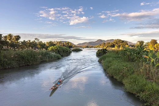
Uruguay River
Major South American river forming parts of three national borders.

via Wikipedia: Uruguay River · see source
The Uruguay River (Spanish: Río Uruguay; Portuguese: Rio Uruguai) is a major river in South America. It flows from north to south and forms parts of the boundaries of Brazil, Argentina and Uruguay, separating some of the Argentine provinces of the Mesopotamia from the other two countries. It passes between the states of Santa Catarina and Rio Grande do Sul in Brazil; forms the eastern border of the provinces of Misiones, Corrientes and Entre Ríos in Argentina; and makes up the western borders of the departments of Artigas, Salto, Paysandú, Río Negro, Soriano and Colonia in Uruguay.
- Length
- 1,838 km (1,142 mi)
- Source
- Serra do Mar, Brazil (confluence of Canoas and Pelotas Rivers)
- Mouth
- Río de la Plata estuary (with Paraná River)
- Drainage basin area
- 365,000 km² (141,000 mi²)
- Main tributary
- Río Negro
- Notable feature
- Submerged canyon up to 100 m deep, visible at Moconá Falls
Lore & Background
The Uruguay River measures about 1,838 km (1,142 mi) in length and starts in the Serra do Mar in Brazil, where the Canoas River and the Pelotas River are joined, at about 200 metres (660 ft) above mean sea level. At this stage, the river goes through uneven, broken terrain, forming rapids and falls. Its course through Rio Grande do Sul is not navigable. An unusual feature is a submerged canyon formed during the Ice Age, when the climate was drier and the river was narrower. Its depth is up to 100 metres (330 ft) below the bottom of the river channel and it is one-eighth to one-third as wide as the river. The canyon is only visible in two places, one of which is the Moconá Falls (also called the Yucumã Falls). However, the falls are not visible for 150 days per year and become more like rapids when they are not visible. Unlike most waterfalls, the Moconá Falls are parallel to the river, not perpendicular. The falls are 10 metres (33 ft) to 12 metres (39 ft) high and between 1,800 metres (5,900 ft) and 3,000 metres (9,800 ft) wide. They are 1,215 km (755 mi) from the mouth of the river. The 17,491 ha (43,220 acres) Turvo State Park, created in 1947, protects the Brazilian side of the falls.
Reader's Guide
The Uruguay River is navigable from around Salto Chico. Its main tributary is the Río Negro, which is born in the south of Brazil and goes through Uruguay for 500 km until its confluence with the Uruguay River, located 100 km north of the Uruguay's confluence with the Río de la Plata, in Punta Gorda, Colonia Department, Uruguay. The river is crossed by five international bridges called (from north to south): Integration Bridge and Paso de los Libres-Uruguaiana International Bridge, between Argentina and Brazil; and the Salto Grande Bridge, General Artigas Bridge and Libertador General San Martín Bridge between Argentina and Uruguay. The drainage basin of the Uruguay River has an area of 365,000 km² (141,000 mi²). Its main economic use is the generation of hydroelectricity and it is dammed in its lower portion by the Salto Grande Dam and by the Itá Dam upstream in Brazil. The name of the river comes from the Spanish settlers' interpretation of the Guaraní language word the inhabitants of the region used to designate it. There are several interpretations, including 'the river of the uru (an indigenous bird)', and '[river of] the uruguá' (an indigenous gastropod, Pomella megastoma).
Did You Know?
- The Moconá Falls are parallel to the river, not perpendicular, unlike most waterfalls.
- The submerged canyon beneath the Uruguay River is up to 100 metres (330 ft) deep and was formed during the Ice Age.
- The Moconá Falls are not visible for 150 days per year, becoming more like rapids during that time.
- The Uruguay River's name may come from the Guaraní word for 'the river of the uru', an indigenous bird.
- The Turvo State Park, created in 1947, protects the Brazilian side of the Moconá Falls and covers 17,491 ha (43,220 acres).
Frequently Asked Questions
Who is the Uruguay River?
The Uruguay River is a major South American waterway stretching 1,838 kilometers from north to south. It acts as a shared boundary among Brazil, Argentina, and Uruguay, making it one of the continent's most geopolitically significant rivers.
What role does the Uruguay River play in regional geography?
It carves out the eastern borders of several Argentine provinces in the Mesopotamia region and the western borders of Uruguayan departments. It also separates certain Argentine provinces from both Brazil and Uruguay, serving as a natural dividing line between three nations.
Where does the Uruguay River begin and end?
Its source sits in Brazil's Serra do Mar, formed where the Canoas and Pelotas Rivers merge. The river ultimately empties into the Río de la Plata estuary, joining the Paraná River as it reaches the Atlantic.
What is the Uruguay River's most notable hidden feature?
Beneath the surface lies a submerged canyon reaching depths of up to 100 meters, which becomes visible at Moconá Falls. This underwater gorge is one of the river's most striking geological characteristics.
Why is the Uruguay River important to the region?
With a drainage basin covering roughly 365,000 square kilometers and the Río Negro as its main tributary, it sustains ecosystems and communities across three countries. Its role as a tri-national border makes it central to regional trade, identity, and diplomacy.
More in Rivers 1-16
Spotted an error? Know more?
This is a living reference — every entry is fact-audited, and reader corrections feed straight into our audit queue. Suggest an edit · See this site's audit record