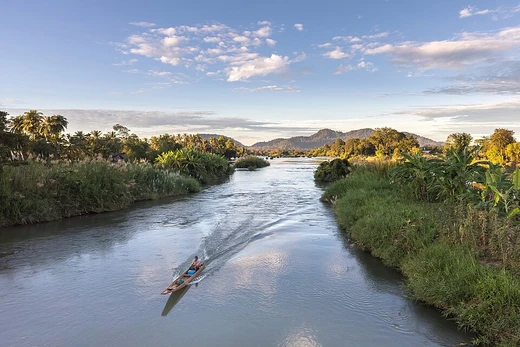
Syr Darya
Central Asian river, historically the Jaxartes, vital for irrigation.

via Wikipedia: Syr Darya · see source
The Syr Darya, historically known as the Jaxartes (jak-SAR-teez; Ancient Greek: Ἰαξάρτης), is a river in Central Asia. It originates in the Tian Shan mountains in Kyrgyzstan and eastern Uzbekistan, and flows for 2,256.25 kilometres (1,401.97 mi) west and north-west through Uzbekistan, Sughd province of Tajikistan, and southern Kazakhstan to the northern remnants of the Aral Sea. It is the northern and eastern of the two main rivers in the endorheic basin of the Aral Sea, the other being the Amu Darya. During the Soviet era, extensive irrigation projects diverted its water into farmland, causing the virtual disappearance of the Aral Sea, once the world's fourth-largest lake.
- length
- 2,256.25 km (1,401.97 mi)
- source
- Tian Shan mountains, Kyrgyzstan and eastern Uzbekistan
- mouth
- Northern remnants of the Aral Sea
- basin_area
- over 800,000 km² (310,000 sq mi)
- annual_flow
- 37 km³ per year
- lowest_elevation_in_Tajikistan
- 300 m (980 ft) above sea level at the Uzbekistan border
Verified Timeline
Lore & Background
When the Macedonian army of Alexander the Great reached the Jaxartes in 329 BC, after travelling through Bactria and Sogdia without encountering any opposition, they met with the first instances of native resistance. In October 329 BC the Macedonians fought the Battle of Jaxartes against the Saka, killing some 1,200 combatants including the leader of the nomads. Alexander was forced to retire south to deal with a revolt in Sogdia. On the shores of the Syr Darya, Alexander placed a garrison in the City of Cyrus (Cyropolis in Greek), which he then renamed after himself Alexandria Eschate—'Alexandria the furthest'—in 329 BC. For most of its history since at least the Muslim conquest of Central Asia in the 7th to 8th centuries AD, the name of this city (in present-day Tajikistan) has been Khujand. In the mid-19th century, during the Russian conquest of Turkestan, the Russian Empire introduced steam navigation to the Syr Darya, initially from Fort Raim but with an important river port at Kazalinsk (Kazaly) from 1847 to 1882, when service ceased.
Reader's Guide
The Syr Darya is significant as one of the two main rivers feeding the Aral Sea basin. Its waters have been extensively diverted for irrigation, especially during the Soviet era to water cotton and rice fields, contributing to the virtual disappearance of the Aral Sea. The amount of water taken from the river was such that in some periods of the year, no water at all reached the Aral Sea. The river irrigates the most productive agricultural regions in Central Asia. Along its course, after crossing the Kazakhstan–Uzbekistan border, Syr Darya meets the Shardara Dam, which is connected to the Aydar Lake. Syr Darya then flows north, before turning west and emptying into the North Aral Sea. The point at which the river flows from Tajikistan into Uzbekistan is, at 300 m (980 ft) above sea level, the lowest elevation in Tajikistan. The Syrdarya–Turkestan State Regional Natural Park was opened in Kazakhstan in 2012, in hopes of protecting the river plain ecosystems, archaeological sites, and historical-cultural monuments, as well as plants and animal species, some of which are rare or endangered.
Did You Know?
- The Syr Darya's earliest recorded name was Jaxartes or Iaxartes in Ancient Greek, possibly from Old Persian 'Yakhsha Arta' ('True Pearl').
- The point where the river flows from Tajikistan into Uzbekistan is, at 300 m above sea level, the lowest elevation in Tajikistan.
- During the Soviet era, irrigation projects diverted so much water that in some periods of the year, no water at all reached the Aral Sea.
- Alexander the Great founded Alexandria Eschate ('the furthest') on the Syr Darya in 329 BC, later known as Khujand.
- The Syrdarya–Turkestan State Regional Natural Park was opened in Kazakhstan in 2012 to protect river plain ecosystems and archaeological sites.
Geography & Hydrology
The Syr Darya is born from two headstreams in the Tian Shan Mountains—the Naryn River and the Kara Darya—which converge in the Uzbek portion of the Fergana Valley before the combined watercourse stretches roughly 2,256 kilometers west and northwest through Uzbekistan, Sughd province of Tajikistan, and southern Kazakhstan toward the northern remnants of the Aral Sea. Its drainage basin spans over 800,000 square kilometers, yet no more than 160,000 of those actually deliver meaningful flow; major tributaries like the Talas and the Chu simply evaporate before reaching the main channel. Annual discharge is a modest 37 cubic kilometers, roughly half what its sister river, the Amu Darya, contributes. After crossing into Kazakhstan, the river encounters the Shardara Dam, which links to Aydar Lake, before turning west to empty into the North Aral Sea. The point where it crosses from Tajikistan into Uzbekistan sits at 300 meters above sea level, the lowest elevation in all of Tajikistan.
Alexander the Great & Ancient Conflict
In 329 BC, the Macedonian army under Alexander the Great, having passed through Bactria and Sogdia without facing opposition, encountered its first serious native resistance at the Jaxartes. The Battle of Jaxartes in October of that year saw the Saka nomads inflict heavy losses—around 1,200 combatants killed, including their own leader—before Alexander was compelled to withdraw south to suppress a revolt in Sogdia. He was wounded in the fighting, and the native tribes subsequently launched attacks on Macedonian garrisons in their towns. The resulting conflict engulfed Sogdia for two years, a period of warfare more intense than any other episode of the Anabasis Alexandri. On the river's banks, Alexander established a garrison at the City of Cyrus, which he renamed Alexandria Eschate, meaning Alexandria the furthest. For most of its subsequent history, from the Muslim conquest of Central Asia in the 7th or 8th centuries onward, this settlement has been known as Khujand, in present-day Tajikistan.
Soviet Water Politics & Ecological Collapse
During the Soviet period, an elaborate resource-sharing arrangement governed the rivers of Central Asia. Kyrgyzstan and Tajikistan, as the upstream nations, ceded summer water from both the Amu Darya and Syr Darya to Kazakhstan, Turkmenistan, and Uzbekistan. In exchange, they received coal, natural gas, and electricity from those downstream states during winter. This system collapsed entirely after the 1991 dissolution of the Soviet Union, and the independent Central Asian nations have been unable to reconstruct an equivalent framework. Inadequate infrastructure, poor water management, and outdated irrigation techniques have compounded the crisis. The most visible consequence is the virtual disappearance of the Aral Sea, once the world's fourth-largest lake, driven by massive expansion of irrigation canals in the Middle and Lower Syr Darya to water cotton and rice fields. In some seasons, no water at all reached the sea.
A River of Many Names
The Syr Darya has worn more names than perhaps any other waterway in Central Asia. The earliest recorded form, Jaxartes or Iaxartes, appears in Ancient Greek sources connected to Alexander the Great's campaigns. Scholars trace this to the Old Persian Yakhsha Arta, meaning True Pearl, possibly an allusion to the river's glacially-fed, pearl-colored water. Turkic peoples used the name Yinçü, also meaning Pearl river, borrowed from Middle Chinese, and Tang Chinese dynastic records rendered it as Yaosha River and later Ye River. The Sogdian dialect, an Eastern Iranian language descended from the Saka group, contributed the form Yaksart, meaning flowing or streaming. The current name is far more recent: the word Syr, meaning secret in Tajik, does not appear before the 16th century, and the full compound Syr Darya dates only to the 18th century. In the 17th century, the Khiva ruler Abu al-Ghazi Bahadur Khan referred to the Aral Sea itself as the Sea of Sïr.
Gallery
Frequently Asked Questions
What is the Syr Darya and where does it come from?
The Syr Darya is a major Central Asian river that begins in the Tian Shan mountains spanning Kyrgyzstan and eastern Uzbekistan. From there it travels roughly 2,256 kilometers west and north-west before emptying into the northern remnants of the Aral Sea.
What was the Syr Darya called in older records?
Historically the river went by the name Jaxartes, a designation that appears in many pre-modern geographical texts. The name Syr Darya (meaning 'Grey/Blue River' in Turkic) is what you will see in modern usage.
Why does the Syr Darya matter so much to Central Asia?
It drains a basin of over 800,000 square kilometers and delivers around 37 cubic kilometers of water every year, making it a lifeline for irrigation and agriculture in Uzbekistan, Tajikistan, and southern Kazakhstan. Without it, vast stretches of the region's farmland would simply not survive.
Does the Syr Darya flow into the ocean?
No — it is part of a closed, endorheic basin, so its waters terminate in the shrinking northern remnants of the Aral Sea rather than reaching any sea or ocean. It is the northern and eastern of the two principal rivers feeding that basin, the other being the Amu Darya.
What is the lowest point the Syr Darya reaches in Tajikistan?
At the Uzbekistan border, the river sits at roughly 300 meters (about 980 feet) above sea level, which is the lowest elevation it attains while still within Tajik territory. Beyond that point it continues its long journey westward toward the Aral Sea.
More in Rivers 1-16
Spotted an error? Know more?
This is a living reference — every entry is fact-audited, and reader corrections feed straight into our audit queue. Suggest an edit · See this site's audit record