Ural (river)
River forming the Europe-Asia boundary, third-longest in Europe.

Deniska000 · CC BY-SA 4.0
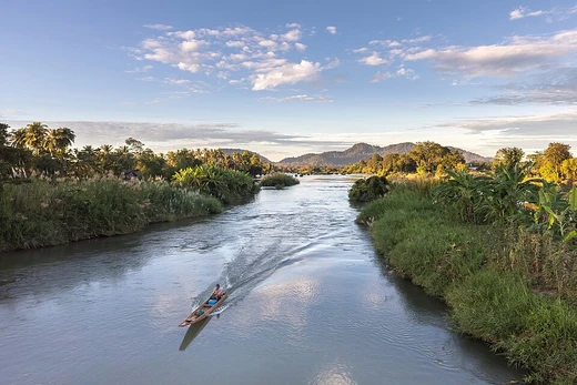
The Ural River, historically known as the Yaik, is a major watercourse flowing through Russia and Kazakhstan. It is conventionally considered part of the boundary between the continents of Europe and Asia, originating in the southern Ural Mountains and discharging into the Caspian Sea.
- source
- Mount Kruglaya, Ural Mountains, Bashkortostan, Russia
- mouth
- Caspian Sea, near Atyrau, Kazakhstan
- countries
- Russia, Kazakhstan
- discharge
- Average 400 m³/s near Kushum village
Lore & Background
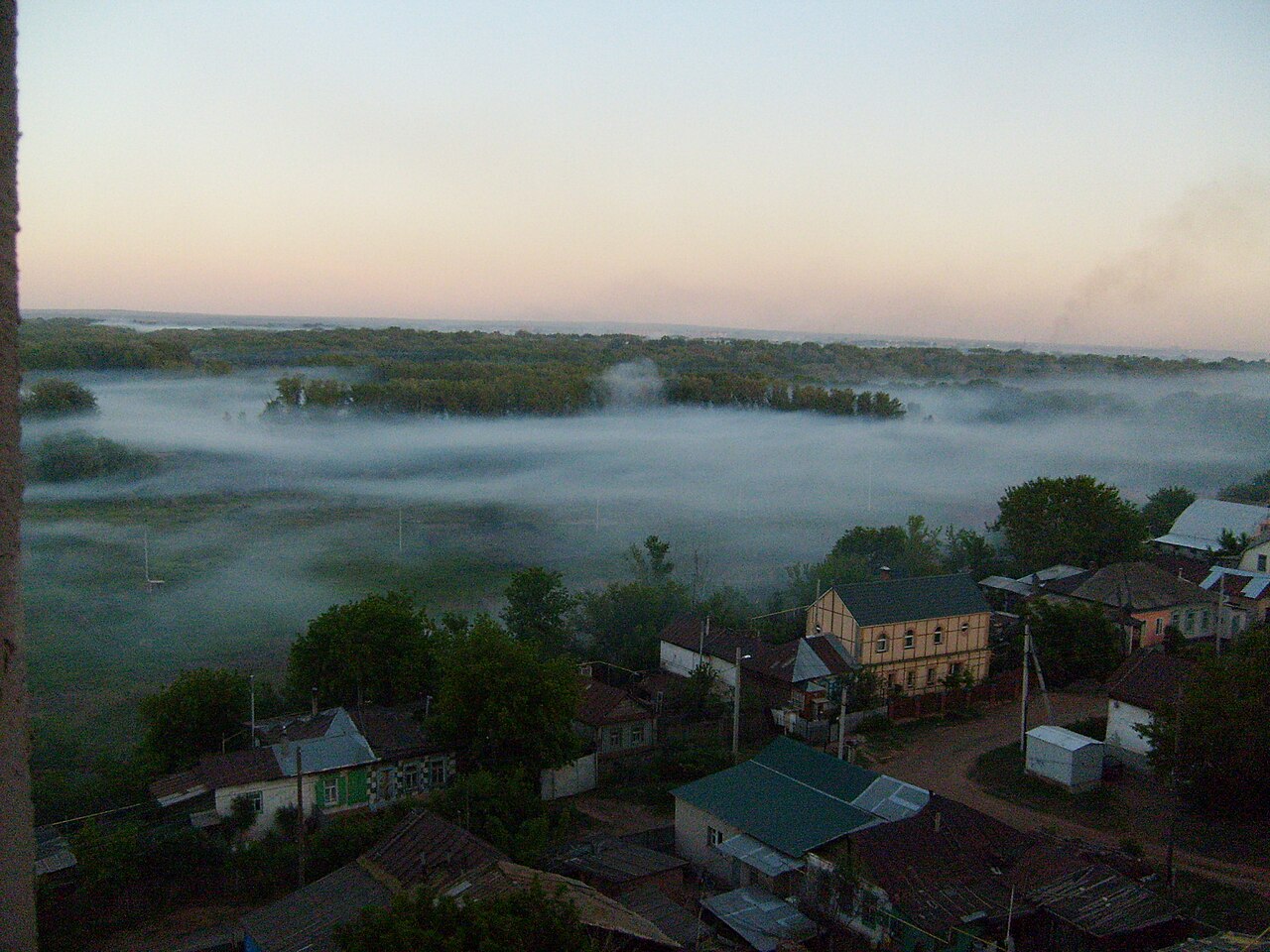
The Ural River rises near Mount Kruglaya in the Ural Mountains, flowing south parallel to the Tobol, through Magnitogorsk, and around the southern end of the Urals. It passes through Orsk, where it turns west for about 300 kilometers to Orenburg, where the Sakmara River joins. From Orenburg it continues west into Kazakhstan, turning south at Oral and meandering through a broad flat plain to form a digitate delta near Atyrau. The river's etymology is disputed: Ptolemy called it Δάϊκος in the 2nd century AD, with some scholars linking it to Turkic or Sarmatian origins, while others suggest Finno-Ugric roots.
Reader's Guide
The Ural River holds significance as a traditional continental boundary between Europe and Asia, marked by monuments such as the bridge in Orenburg. Historically, it was a vital trade route on the Silk Road, with the city of Saray-Jük serving as a stronghold of the Golden Horde and later the Nogai Horde. The river's basin became home to the Yaik (later Ural) Cossacks, who developed unique fishing techniques like bagrenye—spearing hibernating sturgeons through ice—and constructed uchug weirs to control fish migration. The river's hydrography is dominated by snowmelt, with spring floods accounting for 65% of annual discharge. Its delta, with a tree-like shape, supports rich fish populations including sturgeon, starry sturgeon, and beluga.
Did You Know?
- The river's delta has a 'digitate' (tree-like) shape, formed by slow flow and heavy sediment delivery into the Caspian Sea.
- The Cossacks practiced bagrenye, spearing hibernating sturgeons through ice on only one day each year.
- The river's etymology is disputed, with possible origins in Turkic, Sarmatian, or Finno-Ugric languages.
Continental Crossroads
The Ural River carves a path that has shaped how humanity divides its world. Rising on the slopes of Kruglaya Mountain in the Uraltau ridge within Bashkortostan's Uchalinsky District, this 2,428-kilometre waterway threads southward past Magnitogorsk, swings west through Orsk, and eventually meanders across a broad flat plain in Kazakhstan before emptying into the Caspian Sea just below Atyrau. At 60 to 80 metres wide at its mountain source, it broadens to five kilometres after passing through the Yaik Swamp, and by its lower reaches it splits into the shallow, fish-rich Yaik distributary and the deeper, navigable Zolotoy channel. The river's mouth produces a striking digitate delta, a tree-like branching pattern that naturally forms when a slow-moving, sediment-heavy stream meets a calm sea. Ranked third among European rivers behind the Volga and Danube, and eighteenth in Asia, the Ural has long served as the conventional line separating two continents, a boundary as much political as geographical.
A Name in Many Tongues
The river's identity has shifted across millennia and empires. The Greek geographer Ptolemy recorded it as Daïkos in the second century AD, a form that scholar Yulian Kulakovsky links to a Turkic Jajyk, while Gerard Clauson argues for a Sarmatian root. Another thread traces the name to ancient Finno-Ugric languages, whose closest modern echoes include Estonian jõgi, Finnish joki, and Mansi jā, all meaning river or water. The Byzantine emperor Constantine VII called it Geich in his tenth-century treatise De Administrando Imperio, and a Russian chronicle of 1140 recorded it as Yaik. In Bashkir it remains Yayıq, and in Kazakh, Zhayıq. The most consequential renaming came in 1775, when Catherine II, seeking to erase the memory of the Pugachev Rebellion, decreed that the Yaik River and the city of Yaitsk would henceforth be called the Ural River and Uralsk. A single imperial edict thus severed a name that had carried for centuries.
Cossacks, Sturgeon, and Rebellion
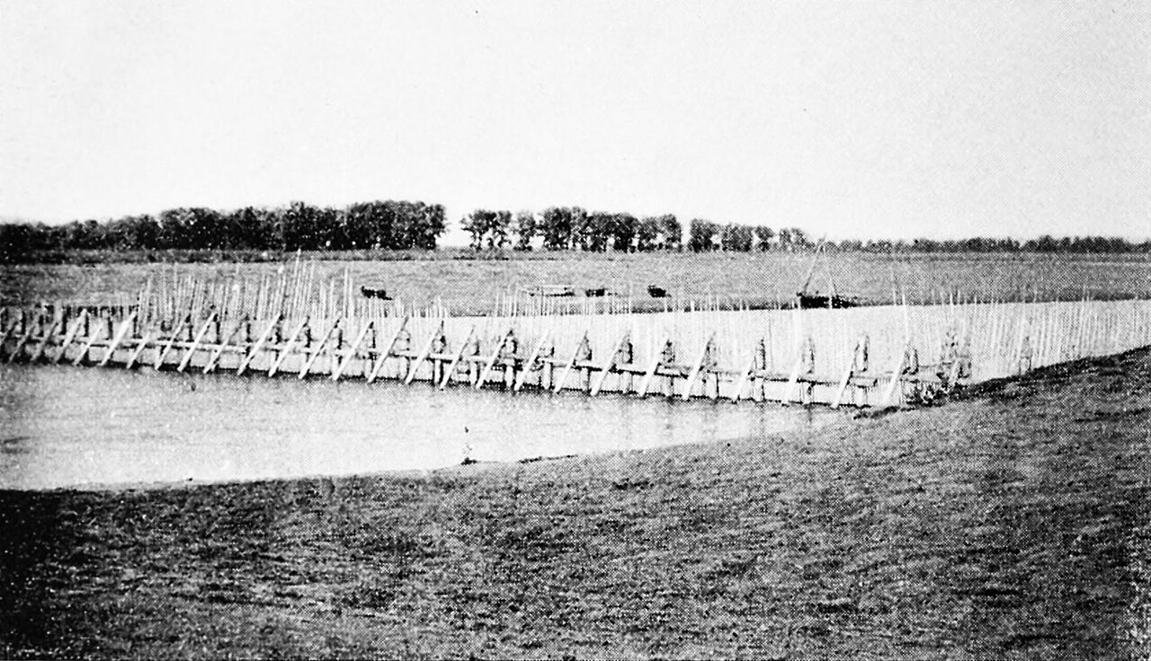
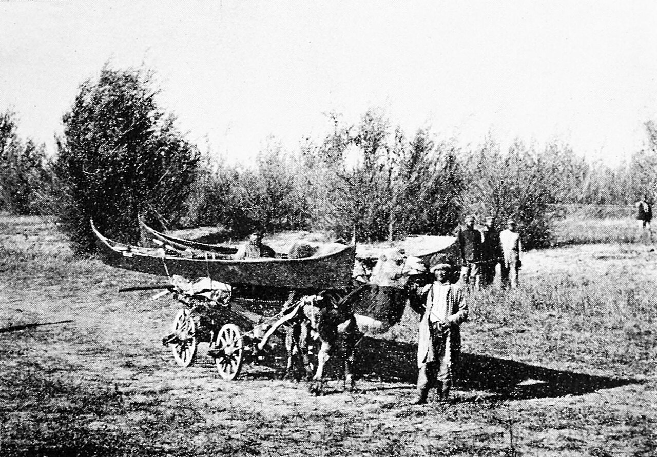
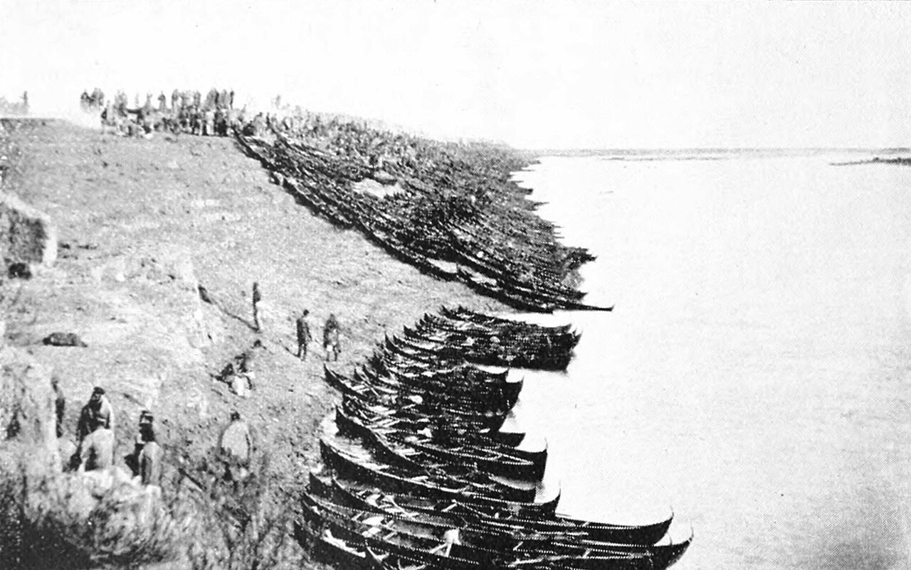
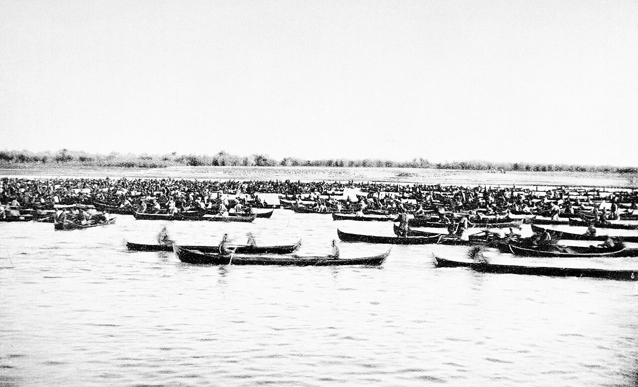
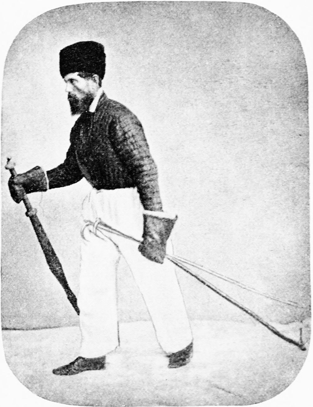
After Russia's late-sixteenth-century conquest of the basin, the Ural's banks became the home of the Yaik Cossacks, whose livelihood centred on sturgeon fishing in the river and the Caspian. Their most celebrated technique, bagrenye, involved a single day each winter when hundreds of Cossacks armed with pike poles would charge onto the ice, shatter it, and spear hibernating sturgeon in their underwater lairs, a practice considered unique to the Ural. Another method, the uchug, was a weir built across the channel to intercept fish migrating upstream to spawn; until 1918, one was erected each summer and autumn near Uralsk to keep the catch within Cossack territory. Yet these same communities chafed under central authority. The Pugachev Rebellion of 1773–75, the largest uprising they mounted, swept across south-eastern Russia and temporarily shattered government control. Catherine's suppression of the revolt triggered the sweeping renamings that rebranded the Yaik Cossacks as Ural Cossacks and scrubbed the old name from the map.
Silk Road Port and Modern Peril
Long before Russian Cossacks shaped the lower Ural, the river sustained one of the Silk Road's key nodes. Saray-Jük, meaning small Sarai, flourished as a trade centre from the tenth through the sixteenth centuries in what is now Atyrau Province. In the thirteenth century it became a stronghold of the Golden Horde, only to be razed in 1395 by Timur's armies. Rebuilt, it served as the capital of the Nogai Horde through the fifteenth and sixteenth centuries before the Ural Cossacks reduced it to a mere village in 1580. The river's power over human settlement has not faded. On 6 April 2024, a levee protecting the city of Orsk gave way during spring snowmelt, flooding more than ten thousand houses in Orenburg and sending water into parts of Kazakhstan. The Ural, which once carried caravans and sturgeon, now reminds the cities along its banks that its seasonal strength remains as unpredictable as it has ever been.
Gallery
Frequently Asked Questions
What is Ural (river)'s role in the continent boundary?
The river is conventionally treated as part of the geographic split between Europe and Asia, with its waters running roughly north-to-south along the continental divide. This boundary role makes it one of the most politically and geographically significant rivers on the Eurasian landmass.
Where does Ural (river) start and where does it end?
Its source sits at Mount Kruglaya in the Ural Mountains within Bashkortostan, Russia, and it ultimately empties into the Caspian Sea near the city of Atyrau in Kazakhstan. Along the way it serves as a shared border between the two nations.
Why is Ural (river) important?
As the third-longest river in Europe behind only the Volga and the Danube, and the 18th-longest in Asia, it plays a key hydrological role in the region. Its average discharge of roughly 400 cubic meters per second near Kushum village sustains agriculture and communities along its banks.
More in Rivers 1-16
Spotted an error? Know more?
This is a living reference — every entry is fact-audited, and reader corrections feed straight into our audit queue. Suggest an edit · See this site's audit record